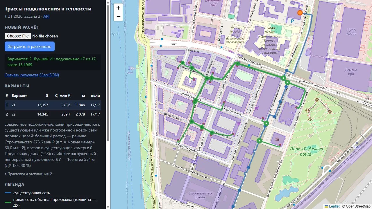
17 of 17
Every building is connected in the main mode, following the organisers’ additional clarifications.
Leaders of Digital Transformation final
For the Moscow Mayor’s Leaders of Digital Transformation contest we built a service that routes new buildings to the heat network on its own: it avoids obstacles, sizes the pipes and prices the work. With it we reached the final of the Moscow IT Department task and came within a hair of the prize places.
The Moscow Mayor’s contest brings together IT teams from across the country. Our task came from the Moscow IT Department: a service that models how new buildings connect to heat networks. We passed the selection and defended the solution in the final before the city’s experts.
Season 2026 figures from the results Sergey Sobyanin announced on 30 October: m24.ru
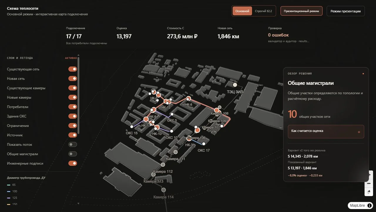
Four tie-ins to the existing network, shared mains and 14 new chambers. The best variant found.
Every building is connected in the main mode, following the organisers’ additional clarifications.
Routes follow the axes of the buildings. In the first submission 53% of the length did.
The run with OpenStreetMap roads became faster and no longer crashes.
A validator and a separate auditor check the geometry, cost and format of the result.
Java 11 and Spring Boot, a job queue, PostgreSQL and Swagger, started with one Docker command. The result map, built with React, TypeScript and MapLibre, shows variants, chambers and pipe sizes, in 3D as well.